Ribbon Creek, Guinn's Pass, and Galatea Lakes
Distance: 21.7m “loop”, you need 2 vehicles for this hike.
Elevation: 1209m elevation
Rating: Moderate to difficult (difficult due to distance, and the Ribbon falls ladders)
Remoteness: both Galatea Lake and Ribbon Creek are popular hikes, but you can find some seclusion on Guinn’s pass (and peak).
Distance From Calgary: 116km to Galatea Lakes Trail Head (1hr 23min), and 88km to Ribbon Creek day use area (1hour)
**You have the option of doing just Galatea, or Ribbon Falls as a day hike, the entire loop as a long day hike, or the entire hike as a multi-day backpacking trip. You can also add in Guinn’s Peak for an extra spicy day.
This explanation starts at Ribbon Creek day use, and finishes at Galatea trail head. You can go either direction and have a great time! I don’t recommend one direction over the other.
The Ribbon Creek Day use area is accessible via Highway 40 at the turn off for the Nakiska Mountain Resort. The trail starts on the west side(back) of the parking lot, and follows along Ribbon Creek through the forest. There is another trail heading north-east from the parking lot, so make sure you walk the correct direction! If you hit a road (Mount Allan Drive) you went the wrong way. The best way to find the correct path is to follow the creek! This trail was badly damaged in the 2013 flood, but has been fully restored!
Ribbon Falls is about 8.7km (374m of elevation) from the parking lot. The walk along the creek follows a gradual incline, and the path is wide and easy to follow. You will hit one trail fork where you continue left around kilometer 3.5. This is well marked. The hike to Ribbon falls is a lovely forested path near the running water of Ribbon Creek. If you are looking for an easy, family-friendly day hike you can turn around here! There is also a backcountry campsite (Ribbon Falls Campground) if you’re looking for an overnight option. I recommend this backcountry site for first time backpackers, and families.
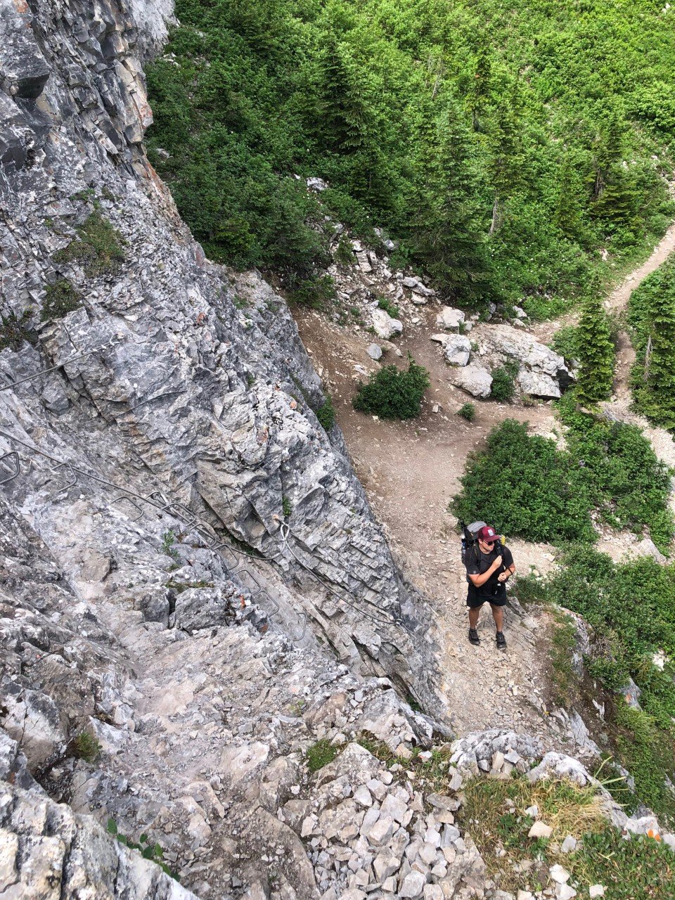
If you want to keep going, the trail continues to the right of the falls. Again, this is well marked and easy to follow. This is where you will hit an extremely steep section that has a chain and ladder to aid you to the top. There are two short chain sections, which are very sturdy and easy to climb. If you are nervous with heights, you may not want to do this trail! I was able to do this with my small dog, but I wouldn’t recommend bringing a big dog on this trail as it would be difficult to get them up this section.
The view from the top of the falls is gorgeous. You get to look back at the valley you just conquered!
The hike to Ribbon Lake from Ribbon Falls is 2km with 291m of elevation. Apart from the steep chain section, it’s an easy trail. There are lots of wildflowers to enjoy here as well!
The next available backcountry site is Ribbon Lake backcountry site which is around the back side of the lake. This is also well marked and easy to find! This is grizzly country, so remember to be extremely bear safe! The backcountry site is frequently monitored from a nearby ranger cabin, so you will for sure need a permit to stay here. The view of Mount Kidd is amazing from here!
I recommend staying at least one night at this campground, as there is multiple days worth of trails to explore in this area! You can go to Buller Pass, Red Peak, Guinn’s Peak, Mount Kidd and even backtrack to Mount Bogart from this campground. These side hikes vary in distance and difficulty, so do your research if you decide to do these!
If you’re continuing beyond this campsite, keep following the path beyond the tent pads around the back of the lake (the trail goes South, South-West). You will travel through a lush green meadow with wildflowers galore! There’s a cute little creek in this area as well, so you’ll have plenty of spots to refill your water. Around 1.2km after the campground, you will hit a Y in the path. To continue over Guinn’s pass take the path to the left, as you want to get to the other side of Mount Kidd.
The top of Guinn’s pass is 1.1km (230m elevation) from the intersection. The route to the top is a really good leg-burner. I promise the view from the top of the pass is more than rewarding enough to make it worth it! You also get to go down next!
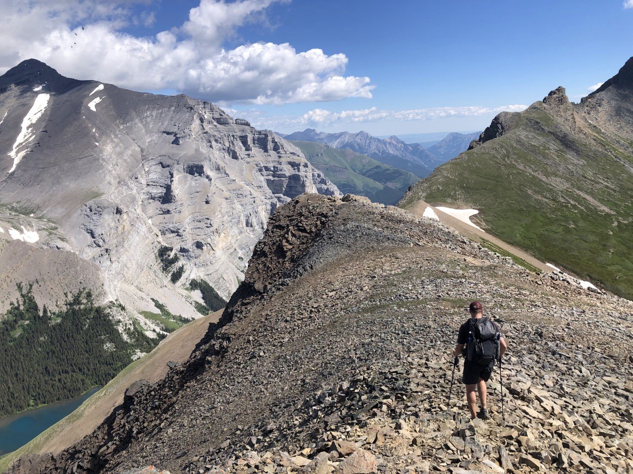
If you have the time, I highly recommend going left to the top of Guinn’s Peak (0.7km and 161m from the pass). The view from here is epic. The above and below pictures are taken from Guinn’s peak.
The trail now follows a steady descent towards Galatea Lakes for 1.5km (-245m elevation). Although tough on your knees, you can soak in the views and enjoy the wildflowers for the whole descent!
Once you get to the bottom on the first descent, you will hit another intersection. Galatea Lakes actually consists of 2 lakes. If you want to see them both, you can veer right to circle the lake. This adds 1.7km to your hike. I highly recommend a swim in Galatea Lake on a warm day if you have the time. It’s freezing, but as refreshing as it comes! It’s also a wonderful reprieve for tired and sore muscles. Galatea is a popular spot for trout fishing, so watch out for fishers when you’re swimming!
If you don’t want to add the 1.7km loop for Galatea Lakes, I would instead head left at the intersection to continue towards Lillian Lake. Lillain Lake is a short 1km(-204m) from here. Lillian Lake is the next place you can camp, if you manage to get a permit! All three campsites on this route are well equipped with an outhouse, bear bins, and picnic tables. Lillian Lake campsite is another site that I recommend for first time backpackers or families (if coming from the Galatea parking area direction).
The path continues on the North side of Lillian Lake following a a gradual descent. Around 2.1km (-189m) passed the campsite, you will hit another intersection. The direction of travel is pretty obvious here, as you want to continue in the downward direction (stay left). The other route travels towards Lost Lake.
If you’ve made it this far, congratulations! You are now in the final stretch. Galatea Day parking is another 4.2km(-287m) from this intersection. This section follows the beautiful Galatea Creek through the forest. This final descent is gradual, but can feel long on tired legs! It’s one of those paths that make you that much more excited to see your car at the end of the day. I highly recommend having some snacks in your car to munch on as your reward for a job well done. This route is an epic adventure!


