Tent Ridge
Distance: 11.1km (Loop)
Elevation Gain: 857m
Rating: difficult
Remoteness: This is a popular hike, you will likely run in to other hikers on this ridge!
In our opinion, tent ridge is the perfect hike. It has such stunning views that it’s honestly hard to believe they’re real. This hike is approximately 11.1km and has 857m of elevation gain, so it’s a great length for a day hike. The route is a horseshoe loop, so you can do it either clockwise or counterclockwise. Most people recommend going counterclockwise, as the climb up onto the ridge on this side has a bit more of a scramble feel to it. We are big fans of scrambling up instead of down! However, you honestly can’t go wrong with whatever way you decide to go. The “scramble” is a tiny bit exposed with some loose rocks, but 100% doable for anyone willing to take their time.
The parking lot for this hike is more of a widening of the road, about 1.8km up Mount Shark Road from Smith-Dorrien/Spray Lakes Trail. Despite there being no designated parking lot, it is relatively obvious where to park, as there are usually half a dozen other cars parked there at all times. To follow the clockwise route, cross the road and head back towards Spray Lakes Trail for about 200m. The trail head is hard to miss!
From here, you will follow a steady incline through the trees for just under 2km. The trail currently has lots of fallen trees to navigate over or around, but this is part of the fun! Take your time to appreciate the diverse green scenery.
The trees soon clear into a meadow. This meadow follows the center between both sides of the horseshoe you are about to climb. Looking up, you can see the remainder of your hike! This meadow is gorgeous. It has a stream running through it, and many larches to appreciate. If you are not into climbing a mountain, hiking only to here and having a picnic is still worth the trip!
The path eventually veers to the left, guiding you to the beginning of your ascent up the horseshoe. The upward hike is quite the leg burner from here, as you are doing nothing but gaining elevation until the top of the ridge. The climb is narrow and steep in a few parts of the ascent, requiring some hands on climbing. However, each of these spots lasts only a few short meters. If you have a fear of heights, you might not be happy hiking here. However, this is our recommendation to anyone who wants to get in to scrambling, as these areas have lots of hand and foot holds, making the climbing relatively easy. Anyone can do this if they set their mind to it! Take your time, and look back at the view often to remember why the climb is worth it!
The hardest of the scrambling is over once you reach the weather station. The wind along the ridge can be treacherous and cold. We highly recommend a wind breaker, toque and gloves in case of a windy day. The weather station is a good place to stop for lunch in this weather, as it is the best place to block the wind. If it’s warmer, we recommend going to the highest ridge point before stopping.
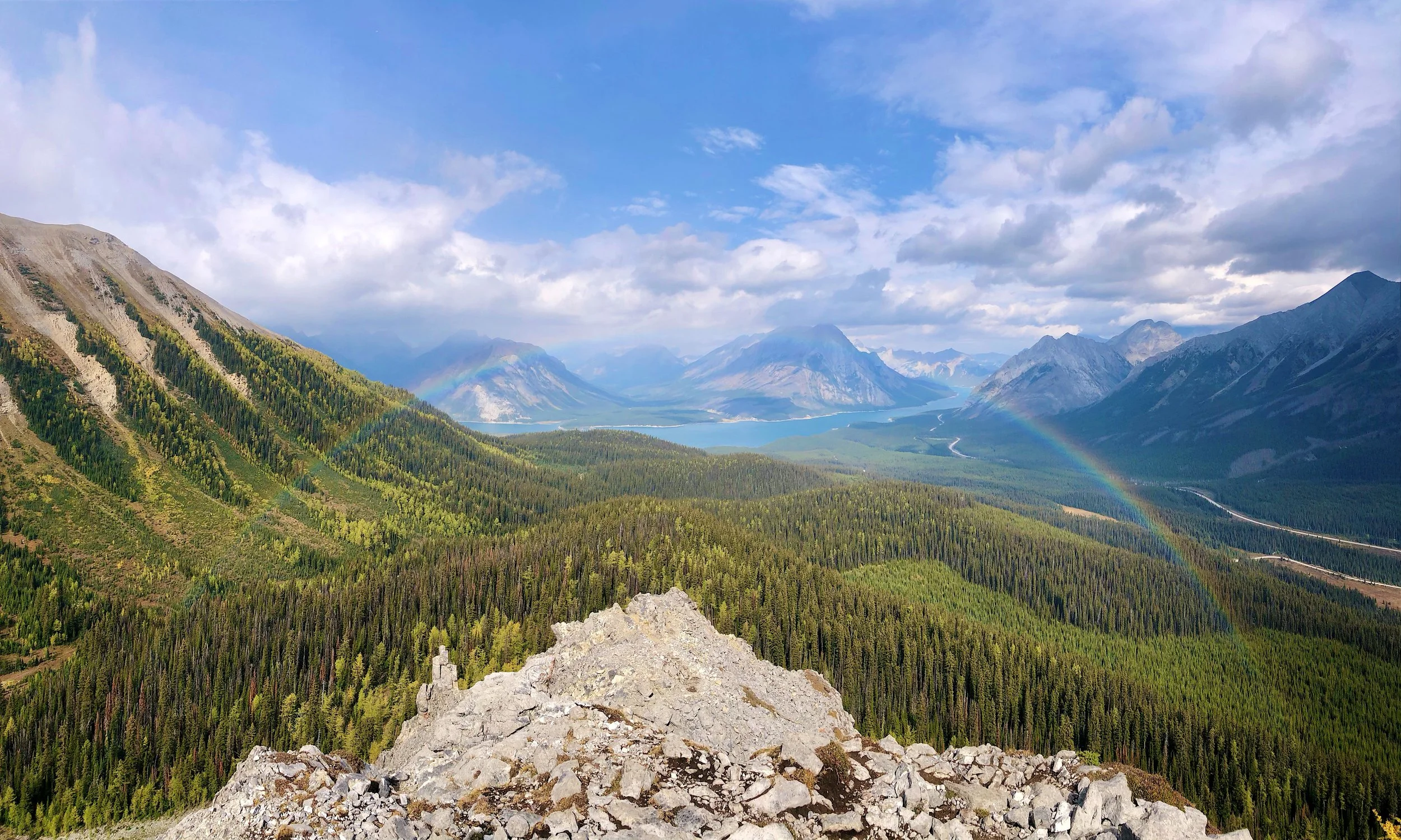
From the weather station, you head downhill, losing some of your well-earned elevation gain, prior to your final steep ascent to the true peak. The views continue to be spectacular, giving you motivation for your final push to the summit. The reason Tent Ridge is one of our favorite hikes, is the views at the peak vary depending on the direction you look. To the south-east, the mountains are jagged and rocky. To the south-west, you get a view of vast forest and the small Tryst Lake. To the north-west you get an epic view of Spray Lakes. Finally on a clear day, you may be able to catch a glimpse of Mount Assiniboine to the north-east.
The hike continues up and down going north from the summit. The path is made up of large boulders that require some route-finding to maneuver around. Due to the popularity of the hike, there are many worn in routes long the ridge. Although all routes are doable, some are definitely more precarious than others. If the path is starting to feel sketchy, it is likely that there is a better path nearby with less exposure. Again, anyone with a fear of heights will not want to look down on this part of the path. Your final view before the descent down from the horseshoe gives the most epic view of Spray Lakes. This is beautiful for a sunrise or sunset view, if hiking in the dark doesn’t scare you!
The descent involves navigating scree, and some slippery, muddy sections. As always, take your time and watch your footing. Once you are off of the ridge, you get to spend another 2km enjoying the trees before reaching a cross country skiing trail. Go right here and follow this for another .6km to reach the parking area!
This hike can get some solid snow coverage on the ridge, obviously depending on snowfall in the winter season. From our experience, mid to end of June is a pretty safe time to ensure you don’t run into too much snow. If you are planning on doing this hike only once in a season, September/October is by far the most beautiful time to conquer it, as the Larches are incredible this time of the year.
This is a hike we do time and time again, and it honestly never gets old. We hope you will love it as much as we do!


